




 Share
Share







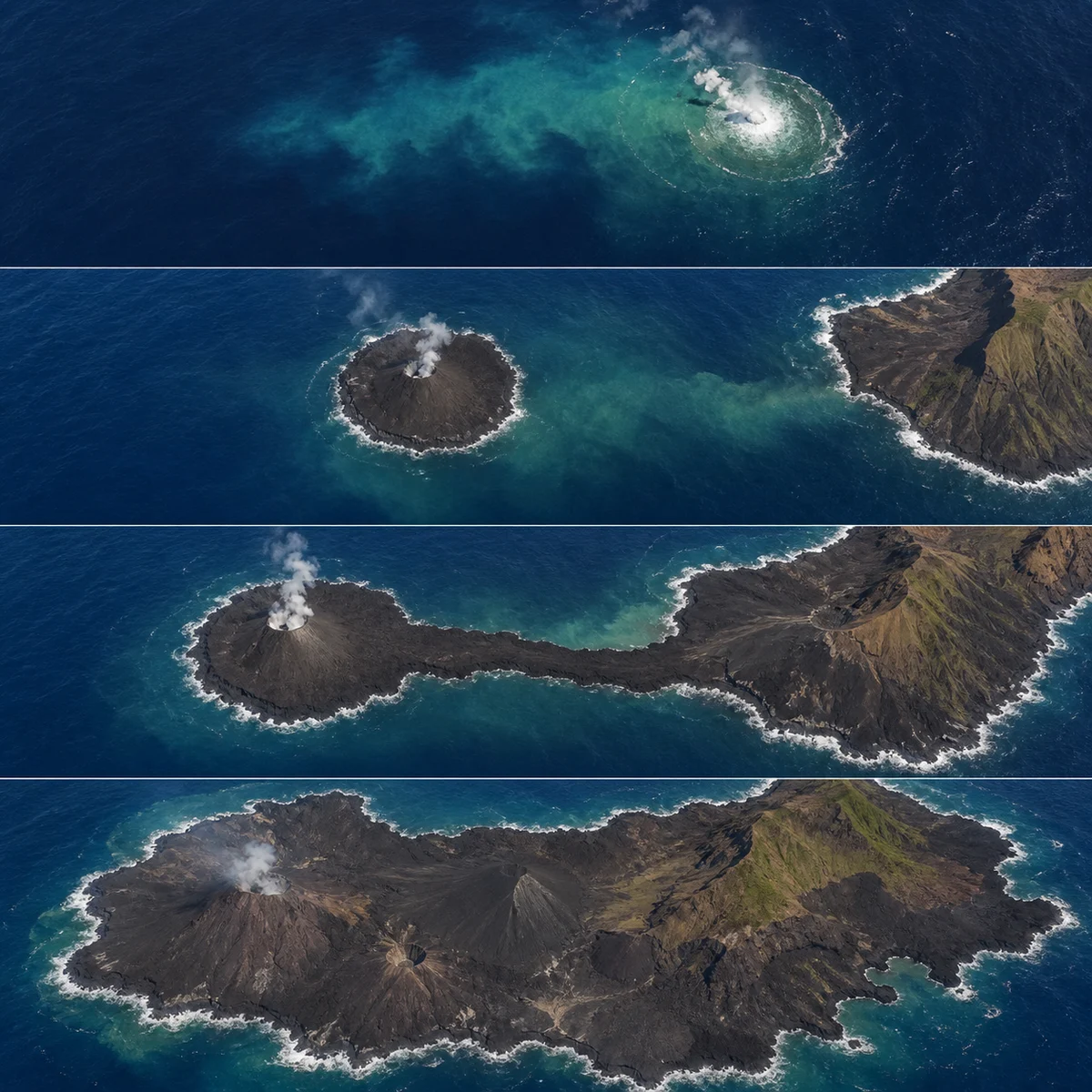
In 2013, a submarine eruption broke the Pacific surface beside Japan's Nishinoshima and began piling lava into new land. At first, the newborn island and its older neighbor were visibly separate. Continuing eruptions expanded the fresh lava flows until they crossed the water between them, joining both pieces into one growing landmass.
The new island did not eat the old one in a biological sense. “Swallowed” describes what the map began to show: lava surrounded and incorporated much of the earlier island's outline as the merged coast expanded to many times the old landmass's size. Satellite images made the sequence legible, from offshore eruption plume to separate cone, narrow connection, and broad volcanic platform.
Even that expanded shape was not a final boundary. Active lava can add coast while waves, collapse, and erosion remove or rearrange it. The satellite observations are snapshots in a continuing contest between construction and destruction. Nishinoshima's lesson is that an island need not arrive as one completed object. It can rise next to an older shore, weld itself on flow by flow, and turn yesterday's neighboring island into a surviving patch inside tomorrow's larger one.
Sources