




 Share
Share







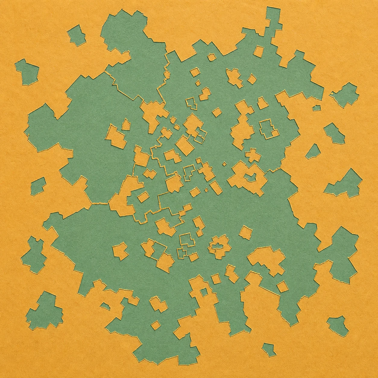
Most borders make cartographic sense at a glance. A line follows a river, crosses a field, or runs along a road, leaving one country on each side. Baarle refuses that visual grammar. The Dutch municipality of Baarle-Nassau and the Belgian municipality of Baarle-Hertog interlock as separate pieces, some of them nested inside one another. The border does not merely pass near the town. It repeatedly enters the built environment.
The official Baarle-Nassau municipality describes 22 pieces of Belgian territory belonging to Baarle-Hertog inside the Dutch municipality. These are enclaves: territory of one country surrounded by another. Within Baarle-Hertog lie eight enclaves of Baarle-Nassau. Because those Dutch pieces sit inside Belgian pieces that are themselves inside the Netherlands, they are counter-enclaves—a second layer in the geographic nesting.
Those verified counts matter because Baarle's numbers are often repeated loosely. The municipal formulation gives a stable way to say what is where: Belgian enclaves lie inside Baarle-Nassau, and Dutch enclaves occur inside Baarle-Hertog. The pattern is not one detached island on a map. It is a collection of territorial fragments woven into a shared town.
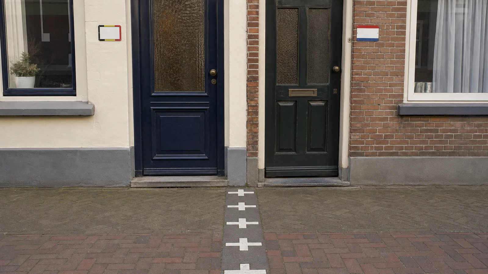
On the ground, white markers trace sections of the boundary across pavement and buildings. A line can move from a street into a shop or through a house. That visibility turns an abstract legal description into an everyday spatial fact. The international border may sit between tables, cross a wall, or divide the footprint of one property even though the structure still works as a single building.
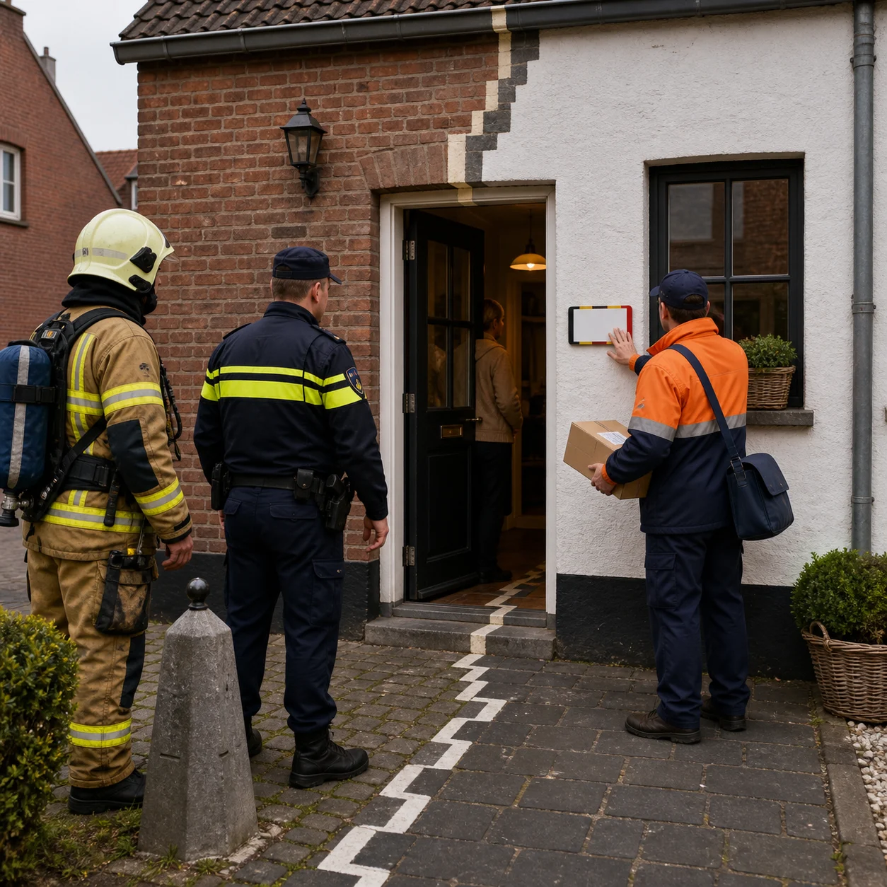
This creates an administrative question that ordinary borders avoid. If one building stands in both countries, where is its address? Baarle-Hertog's municipal house-number guidance answers directly: in Baarle, the front door determines the country in which the property is registered, even if the border runs through the building. The entrance resolves the address without pretending the rest of the footprint lies entirely on the same side.
The municipality provides house-number plates with the Belgian tricolor for properties registered in Baarle-Hertog. A small plate at the door therefore carries more than a street number. It signals the national registration produced by the entrance rule and helps postal delivery and emergency services find the correct administrative system. The threshold becomes both an architectural feature and a jurisdictional key.
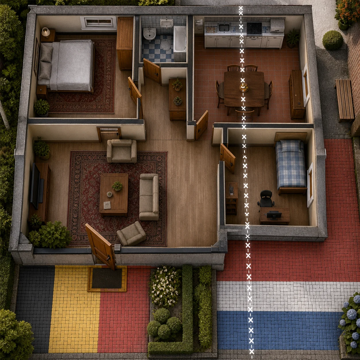
The rule is practical, but it is easy to overstate. It does not mean the front door drags the international boundary around the house. Territory remains where the border places it. A floor can still contain two countries. The rule assigns one registration to a building that crosses that line, using the door as the deciding point for its legal address.
That distinction also keeps the story away from folklore about residents casually changing countries by moving an entrance. Altering a building and its official address would involve municipal processes, and the cited guidance explains registration rather than promising a loophole. The securely documented oddity is enough: a property can straddle two nations, and the ordinary front door supplies the rule for choosing its recorded home.
Baarle makes several scales of geography visible at once. At the broadest scale, Belgium and the Netherlands are neighboring states. Zoom in, and Belgian fragments appear within Dutch territory. Zoom farther, and Dutch fragments appear within some Belgian fragments. Walk the street, and the same nested logic becomes a white line at shoe level. Enter a building, and the front door converts that cartography into an address.
The two municipalities remain distinct even where daily space is shared. Baarle-Nassau is Dutch; Baarle-Hertog is Belgian. Their names sit beside one another because the settlement is physically intertwined, not because the jurisdictions have merged. The border's complexity demands coordination, but cooperation does not dissolve the legal pieces that make the place unusual.
A counter-enclave is difficult to imagine in prose because it asks the mind to hold a container inside a container: Dutch territory inside Belgian territory inside the Netherlands. Baarle lets a pedestrian encounter that structure without opening an atlas. The line leaves the page and passes beneath ordinary movement. A person can cross it on the way through a street rather than at a remote checkpoint.
The front-door rule provides the story's satisfying human scale. Nations are usually represented by flags, customs posts, and vast colored regions. Here, national registration can turn on hinges, a handle, and the side of a line where visitors knock. The door does not settle every legal question created by the border, but it settles one fundamental question for a straddling building: which municipality records the address.
Baarle's map is not an optical illusion. Its Belgian enclaves, Dutch counter-enclaves, marked lines, and door-based registration are functioning geography. The town's weirdness comes from precision rather than confusion. Every nested fragment and threshold rule exists because the boundary is exact enough to pass through places where ordinary life refuses to divide so neatly.
Sources